 BGS Data Catalogue
X ray fluorescence spectroscopy
Type of resources
Topics
Keywords
Contact for the resource
Provided by
Years
Formats
Representation types
Update frequencies
Scale
-

A core scanning dataset from part of the Ellesmere Port-1 drill core that was drilled for unconventional hydrocarbons in 2014. Approximate 40 m of core from the Bowland Shale Formation in the Ellesmere Port-1 (1532.7 – 1663.15 m) was scanned for high-resolution optical images and X-ray fluorescence (XRF) downcore point measurements using the Itrax MC core scanner (Cox Analytical Systems) at the Core Scanning Facility (CSF) at the British Geological Survey. Core scanning was utilised as part of the commission phase of this facility.
-

This data contains high-resolution XRF data scanned from IODP cores recovered from Expedition 369, IODP Sites U1513, U1514 and U1516. Sietske Batenburg was responsible for scanning the Cenomanian-Turonian interval at Sites U1513 and U1516, and the lower half of the Eocene at U1514. Data is available from IODP database: http://web.iodp.tamu.edu/LORE/
-

A core scanning dataset from part of the Llanbedr (Mochras Farm) drill core that was drilled onshore in the Cardigan Bay Basin, Wales, UK. This core scan dataset was obtained using the Itrax XRF Scanner MC at the Core Scanning Facility (CSF) at the British Geological Survey (BGS), UK. It contains X-ray fluorescence (XRF) elemental data expressed as elemental counts or peak areas and optical images of each representative core stick. The dataset was created within the scope of the JET project (Integrated understanding of Early Jurassic Earth system and timescale) - https://gtr.ukri.org/projects?ref=NE%2FN018508%2F1 This project has received funding from the International Continental Scientific Drilling Programme (ICDP) and the UK Natural Environment Research Council (NERC).
-

Bulk sediment elemental analyses by X-ray fluorescence (XRF) spanning the early and middle Eocene succession recovered from borehole 16/28-Sb01. For description of this sedimentary sequence see Haughton et al. 2005. Petroleum Geology: North-West Europe and Global Perspectives, Proceedings of the 6th Petroleum Geology Conference, 1077–1094.
-
This dataset was acquired as part of a NERC-funded Doctoral Training Partnership (DTP) PhD Studentship at the University of Leicester and British Geological Survey between 2014-2018 [grant no. NE/L002493/1] (see also Emmings, 2018 unpublished PhD thesis). This research was conducted within the Central England NERC Training Alliance (CENTA) consortium. This dataset accompanies a manuscript titled "Late Palaeozoic Phytoplankton Blackout: A 100 Myr Record of Enhanced Primary Productivity". Co-authors and co-workers were: Joseph F. Emmings (University of Leicester, British Geological Survey); Sarah J. Davies (University of Leicester); Simon W. Poulton (University of Leeds); Michael H. Stephenson (British Geological Survey); Gawen R. T. Jenkin (University of Leicester); Christopher H. Vane (British Geological Survey); Melanie J. Leng (British Geological Survey, University of Nottingham) and Vicky Moss-Hayes (British Geological Survey). Nick Riley (Carboniferous Ltd) is thanked for sharing biostratigraphic expertise and assistance. Nick Marsh and Tom Knott are thanked for providing assistance during geochemical analyses. This dataset contains the following data (in Microsoft Excel format). 1) Fe species abundance data measured at the University of Leeds using the sequential extraction method of Poulton and Canfield (2005) and pyrite S extraction method of Canfield et al., (1986); 2) Total Fe, Si, Mn and Al major element concentrations (measured using x-ray fluorescence at the University of Leicester; XRF); 3) Total organic carbon (TOC) and inorganic C (MINC) data measured via Rock-Eval pyrolysis at the British Geological Survey; 4) Cu, Mo and U trace element concentration data (measured via XRF at the University of Leicester) and enrichment factors relative to Post-Archaean Average Shale (PAAS; Taylor and McLennan, 1985). Analyses were coupled on 99 sample powders from three positions in the Craven Basin and spanning ammonoid biozones P2c-d to E1c1. See also http://dx.doi.org/10.5285/9ceadcad-a93c-4bab-8ca1-07b0de2c5ed0 for additional sedimentological and geochemical data from Hind Clough, MHD4 and Cominco S9. These data were also interpreted together with 20 drill-core samples previously acquired from Hind Clough (‘HC01’ prefix). See http://dx.doi.org/10.5285/c39a32b2-1a30-4426-8389-2fae21ec60ad for further information regarding this drill-core dataset. References: Emmings, J. 2018. Controls on UK Lower Namurian Shale Gas Prospectivity: Understanding the Spatial and Temporal Distribution of Organic Matter in Siliciclastic Mudstones. Unpublished PhD Thesis. University of Leicester. Poulton, S. W. & Canfield, D. E. 2005. Development of a sequential extraction procedure for iron: implications for iron partitioning in continentally derived particulates. Chemical Geology 214, 209-221, doi:http://dx.doi.org/10.1016/j.chemgeo.2004.09.003. Canfield D., Raiswell R., Westrich J., Reaves CM, Berner RA. 1986. The use of chromium reduction in the analysis of reduced inorganic sulfur in sediments and shales. Chemical Geology, 54(1): 149-155. Taylor S, McLennan S. 1985. The Continental Crust: Its Composition and Evolution. Blackwell Scientific: London.
-

An additional core scanning dataset from the TH0424 drill core that was drilled onshore at Thornton Science Park, Cheshire, UK as part of the UK Geoenergy Observatories (UKGEOS) Cheshire ground investigation funded by UKRI/NERC. The approximately 100 m long core succession comprises the Sherwood Sandstone Group. This additional core scanning dataset pack contains high-resolution optical images and X-ray fluorescence (XRF) downcore point measurements obtained using a Geotek Core Workstation (MSCL-XYZ) at the Core Scanning Facility (CSF) at the British Geological Survey (BGS).
-
These data are derived from a voyage on Australia’s R/V Investigator, IN2019_v04, ‘Hotspot dynamics in the Coral Sea: connections between the Australian plate and the deep Earth’. The voyage surveyed the Tasmantid and Lord Howe Seamounts in the Tasman and Coral Seas, together with the Louisiade Plateau in the Coral Sea, sailing from Cairns on 7 Aug 2019 and arriving in Brisbane on 3 Sep 2019. The voyage summary is available at https://www.marine.csiro.au/data/reporting/get_file.cfm?eov_pub_id=1443. This directory includes datasets derived from ship samples and data as part of NERC grant NE/S01067X/1 (e.g., XRF and ICP-MS geochemistry data). Post voyage analyses by Australian collaborators are not included. More details are available in the README file.
-
Dataset contains an interannual to sub centennial resolution record of carbonate oxygen and carbon isotopes, bulk sediment geochemistry and sedimentology from a 2.95 metre-long core (YC2) from Yaal Chac. The core was dated using a combination of radiocarbon dates and short-lived radio-isotopes. Data are presented in Metcalfe et al (2022) Quaternary Science Reviews https://doi.org/10.1016/j.quascirev.2022.107445
-
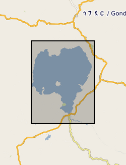
Zr/Rb, Ca/Ti, Rb/K ratios against depth (0.112 m to 62.686 m) and age ( 366 to 150190 yrs). NERC grant, NE/D012996/1, abstract Lake Tana, in the highlands of northern Ethiopia, is the source of the Blue Nile, one of the world's great rivers. Surprisingly, very little is known about the age and history of this lake: one estimate from the 1930's is that it was formed 10,000 years ago by a lava dam. Similarly, little is known about the climatic history of the wider region that comprises the Blue Nile headwaters, despite the fact that the Nile has long been recognized as critical to the resources of ancient and modern Egypt. New geophysical and core data, obtained by us in October 2003 and September 2004 with NERC support, show that the lake may be at least 40,000 years old. Our new data also show that the lake dried out at around 16,000 years ago, and almost certainly at apparently regular intervals during the later stages of the last Ice Age. It is possible that the lake dried because of intense droughts lasting one or two hundred years, and that the droughts were caused by disruption of Africa's monsoon climate when iceberg-laden meltwater from North America flooded the North Atlantic - the Heinrich events. In this new PalaeoTana Project, we aim to test these hypotheses by drilling a sediment core, up to 100m in length, from the northern basin of Lake Tana, in about 10m water depth, and about 2km from shore. The core will be scanned at high resolution using X-ray fluorescence, X-ray and colour imagery, geophysical and magnetic core-scanning technology, without damaging the sedimentary components. The resulting datasets will identify past desiccation events, which will be investigated in detail and interpreted by comparison to sediments of the known drying-out event at 16,000 years ago. Dating the sediments by appropriate methods including luminescence, tephrochronology, and Argon-Argon dating will allow precise estimates of the timing and duration of the drought events. The relative timing of these events in comparison with abrupt climatic events in ocean cores (especially Heinrich events), and in other continental records, will allow inferences about the global- scale mechanisms of abrupt climate change. The data can also be used to test climate models, and thus to help judge the accuracy of model-predicted abrupt climate change in the future. A long core record of past climate and environment from this part of Africa would have major significance for understanding both regional environmental change, because of the influence of the Nile on NE Africa and the eastern Mediterranean, and global climate. It will contribute to understanding how future changes in ocean temperature and circulation will affect global climate, especially in the heavily populated monsoon regions of Africa and Asia. It will also have significance for understanding the later stages of human evolution in and dispersal out of Africa, by providing a record of the environmental changes that influenced early human populations and their water, plant and hunting resources.